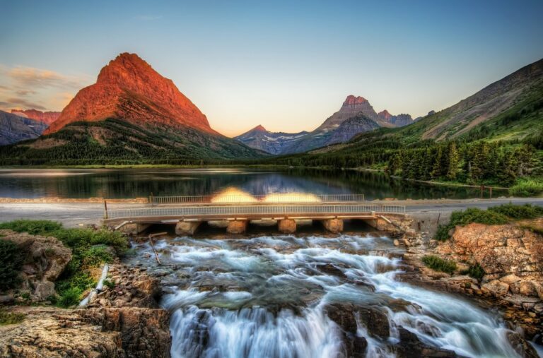
10 Great Hikes on Smith-Dorrien Trail – Hiking Alberta | Hiking with Barry
Spectacular hikes along Smith-Dorrien Trail south of Canmore in Kananaskis Country west of Calgary, Alberta, Canada.

Following are ten great hikes accessed from Smith-Dorrien/Spray Trail (Hwy 742) south from Canmore and west of Calgary, Alberta, Canada.
It is always a good idea to check with a Visitor Centre for current trail conditions and the weather forecast. Conditions at altitude can change quickly and dramatically. Current information can be very important.
The Smith-Dorrien/Spray Lakes Trail is a gravel road, mainly wide, which is generally well-maintained but vulnerable to fickle and dynamic mountain weather.
Click on the following red links for more detailed information about the hike.
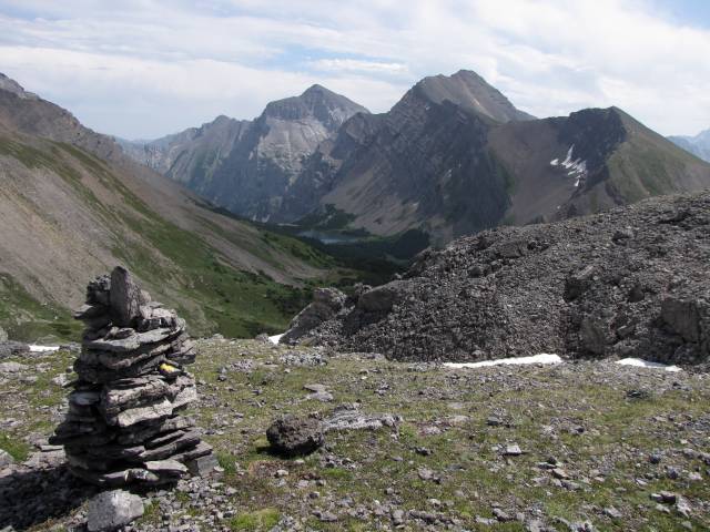
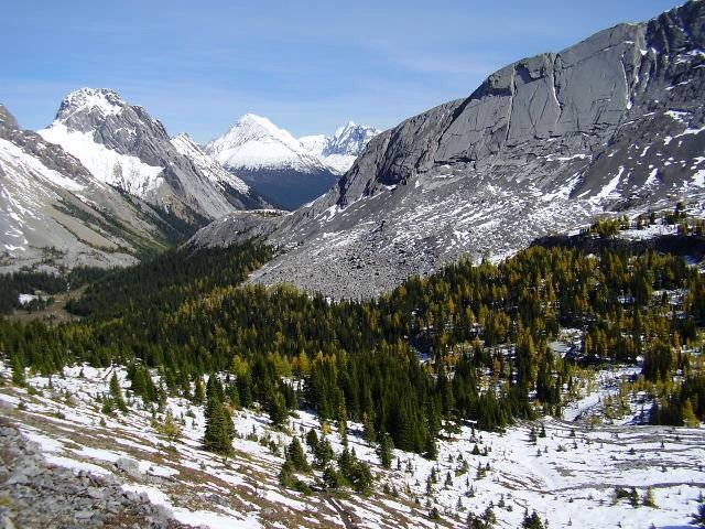
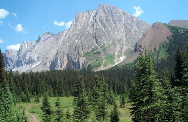
South Buller Pass is an outstanding hike through a wide variety of vistas and terrain culminating in an excellent view across the bowl containing Ribbon Lake beneath massive Mount Kidd. Guinn’s Pass is on the far side of the bowl and on a clear day there is an excellent view of Mount Assiniboine.
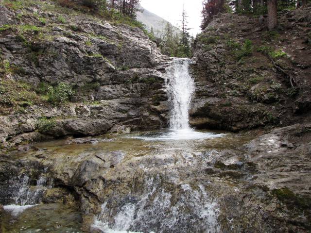
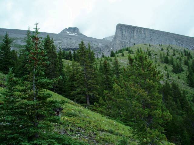
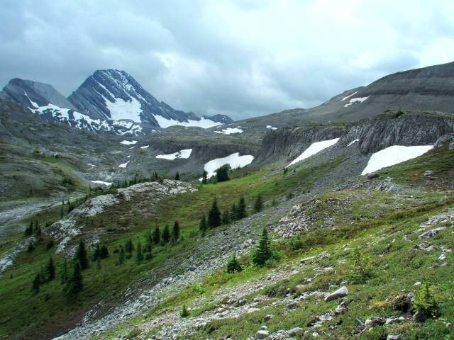
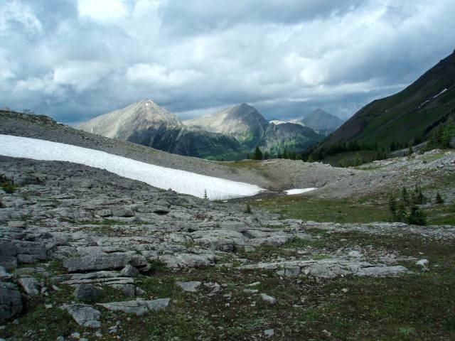
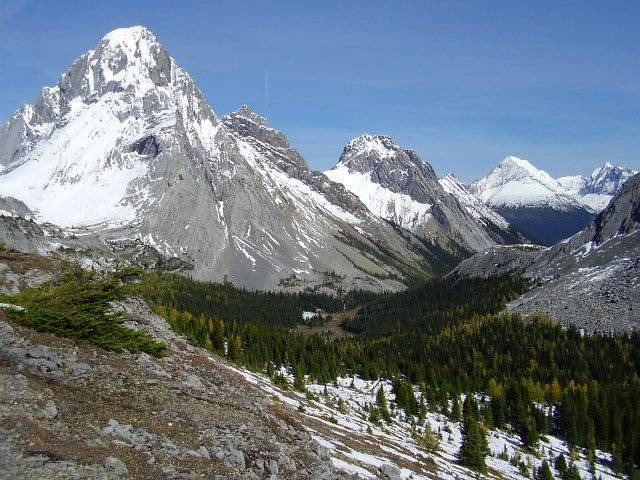
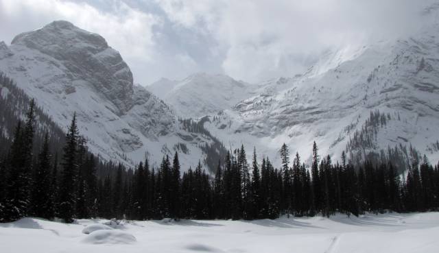
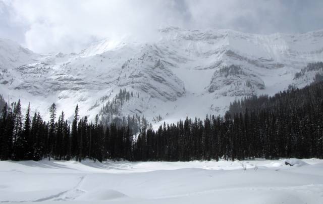
2. Mist Creek and Mist Ridge
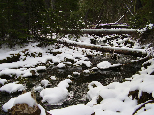
A beautiful forest walk beside creeks, and through wetlands, beneath massive Mist Mountain leads up the switchbacks to Rickert’s Pass above Burns Mine in the Sheep River Valley beyond.
The return to the trailhead on Kananaskis Trail can be achieved by hiking the top of Mist Ridge for hours of breathtaking views of impressive, surrounding mountains and magnificent valleys. Long day but the incredible vistas make the effort seem shorter.
![MistCreek_15[1]](/sites/hikingwithbarry.com/files/wp-content/uploads/2013/04/MistCreek_151.jpg)
![MistRidge_22[1]](/sites/hikingwithbarry.com/files/wp-content/uploads/2013/04/MistRidge_221.jpg)
![MistRidge_28[1]](/sites/hikingwithbarry.com/files/wp-content/uploads/2013/04/MistRidge_281.jpg)
![MistRidge_39[1]](/sites/hikingwithbarry.com/files/wp-content/uploads/2013/04/MistRidge_391.jpg)
![MistRidge_52[1]](/sites/hikingwithbarry.com/files/wp-content/uploads/2013/04/MistRidge_521.jpg)
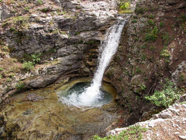
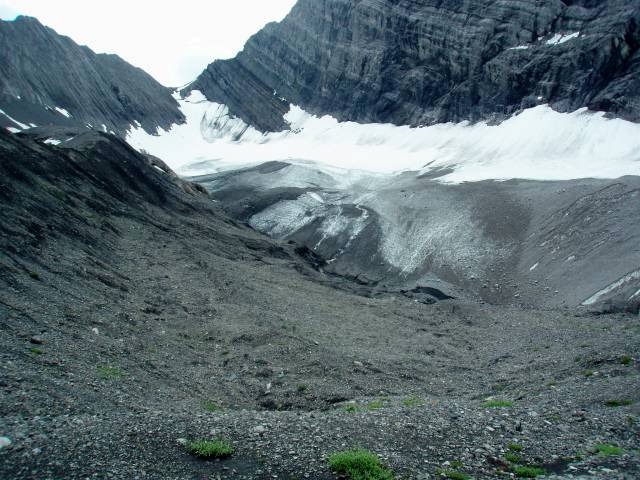
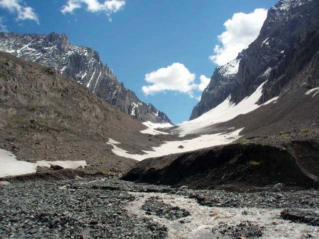
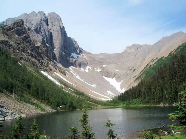
Old Goat Glacier’s elusive trail-head leads through forest and along magical creek flow to a beautiful waterfall which is runoff from the glacier. A rocky climb on obvious trail to the lateral moraine allows hiking along the top of the glacier’s moraine.
It is a fascinating day where marmots will watch your progress. The potentially short day can be extended with quiet reflection in the surrounding splendor or by further exploring the unique terrain. One of my all-time favorite hikes.
4. Read’s Ridge
This hike has a pleasant beginning on the far side of the Smith-Dorrien Trail from Sparrowhawk parking but is rudely interrupted by a stiff climb on rocky trail to the top of the ridge for spectacular views of the Spray Lakes and surrounding mountains.
The hike can be extended to Read’s Tower, (final approach requires caution), clearly visible in the distance on good trail beneath Mount Sparrowhawk, a popular, year-round hiking or rock and ice climbing destination.

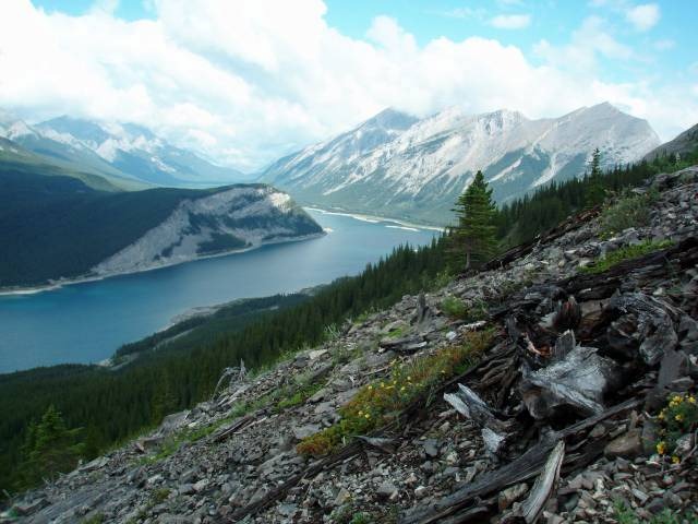
The hike to Burstall Pass is a classic hike past Burstall Lakes, the alluvial fan created by Robertson Glacier, and through forest, meadow and glacier-carved rock walls culminated by incredible mountain-top views in all directions.
The trail continues on but Burstall Pass is an excellent full day objective. Perpetually memorable, the diverse beauty leaves an indelible impression of sweeping vistas.

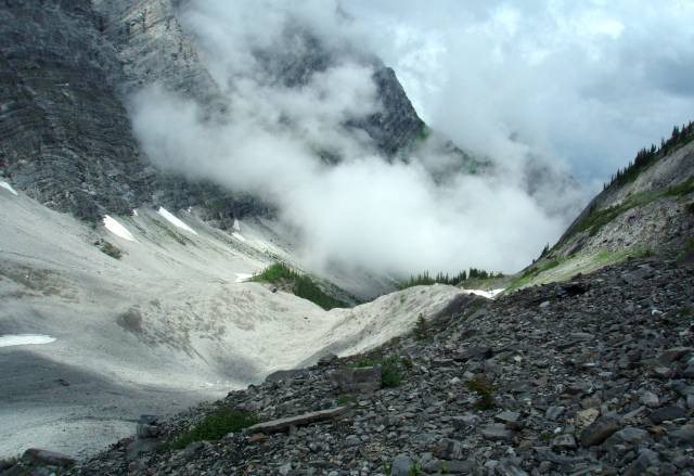
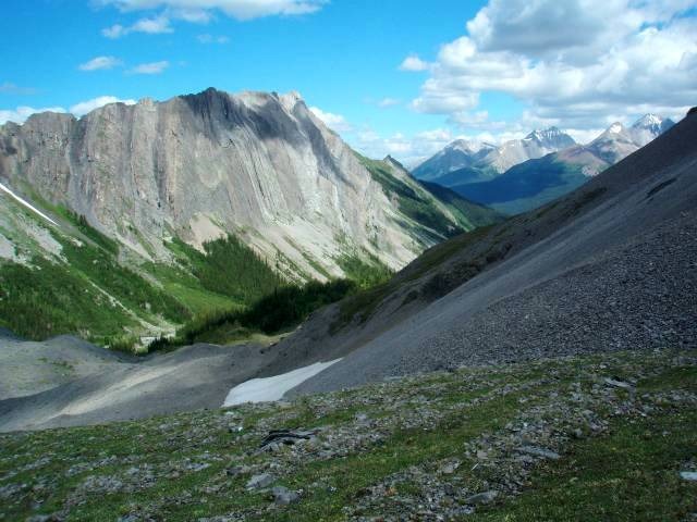
The hike to French Glacier is substantially more rustic than the trail to Burstall Pass. Trail to French Glacier is frequently interrupted with dead fall and detours, but the effort discloses wilderness gems and a glacier-created valley with perpetual running water.
The glacier can be negotiated in later season with crampons by experienced and well equipped mountaineers. Unfolding vistas are mesmerizing. Make a mental note of the location where you hike out of the treeline so you can find the way back onto the trail after time spent near the glacier.
Many wide-eyed WOW! moments on this one. Long, rugged day for the average day hiker.
7. Karst Spring
You will likely hear it before you get to the viewing and interpretive platform over Karst Spring. Complex trail systems at the Mount Shark Ski Area make planning for the hike important as well as careful attention to signage and trail junctions in the popular Shark Lake area. This is an excellent hike with unique features.
8. Tryst Lake
Tryst Lake is a short, steep and potentially wet hike up the creek to pristine, isolated and incredibly beautiful Tryst Lake. There is an opportunity to gain the ridge and hike to the Fist which looms over the tiny lake. It is an ideal location for a day of peaceful meditation where you can enjoy your lunch in the presence of wildflowers, Richardson’s Ground Squirrels and Golden Mantled Ground Squirrels who will become your instant friends.

9. Chester Lake
Like Burstall Pass, Chester Lake is a year-round, classic hike, snowshoe or ski whose trailhead is across Smith-Dorrien Trail from parking for the Burstall Pass hike. Progress on modest, well graded ascent through forest opens into a mountain surrounded valley. A quiet, relaxing day at Chester Lake is a noble goal, however, there is an option to hike further past Elephant Rocks for talus hiking to the scree col access at Fortress Mountain. It can be as long a day as you choose to make it.

10. Rummel Lake
Rummel Lake is a pristine lake at the base of Mount Galatea. The trail continues along the base of The Tower to an outstanding view into the valley beyond containing Lost Lake. It is possible, with two cars, for experienced and energetic hikers to hike through the mountain range onto Galatea Creek Trail leading to the Galatea Parking area at Kananaskis Trail (Hwy 40).
Bonus hike # 11. Warspite Lake and Black Prince Cirque
The signed trail-head parking area accesses a creek crossing and a pleasant, sustained forest ascent to Warspite Lake bound by tall mountains and impressive rock walls.
Hiking further into the spectacular Black Prince Lakes can be compromised by avalanche risk for a significant portion of the year.
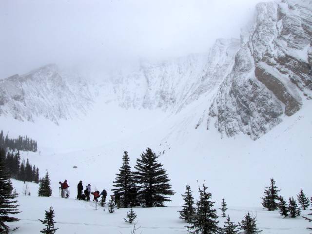
Access recently was discouraged by bear activity so it is best to check with the Peter Lougheed Visitor Information Centre on Kananaskis Lakes Road. Warspite Lake is an excellent snowshoe in winter months.
Prior to beginning any hike, please, carry a map, as well as consulting and carrying a good hiking guide. It is always wise to obtain current conditions from a Visitor Centre. Tell someone where you are going and how long you expect to be there. On completion, call to let them know you have completed your hike.
There is a huge assortment of hikes along Smith-Dorrien Trail (Hwy. 742). Stay safe, carry layers and pack everything you may need to enjoy a great day.
Happy trails and stay safe.