10 Easy Hikes near Calgary – Hiking Alberta | Hiking with Barry
This is a collection of ten easy and scenic hikes for beginners near Calgary, Alberta, Canada.

Cascade Ponds In Banff National Park, Alberta, Canada
To stay safe, and build skills gradually, it is important to choose hikes appropriate to individual skill levels and capability. Following are a few hikes worthy of consideration by beginners.
Nearly anyone can do these short and easy day hikes. Also, there is a category entitled ‘Easy Hikes’ to provide some guidance for beginners. Consult a good hiking guide, carry the guide and a map, and gear up appropriately for the terrain and a potentially broad range of weather.
Click on the red links for more detailed information about each easy hike.
1. Eau Claire Trail – Kananaskis Country – Hiking Alberta

Kananaskis River from the Eau Claire Trail in Kananaskis Country, Alberta, Canada
2. Wedge Pond – Kananaskis Country – Hiking Alberta
 Wedge Pond between Mount Kidd and ‘The Wedge’ on Kananaskis Trail in Kananaskis Country, Alberta, Canada.
3. Big Hill Springs Provincial Park – Airdrie or Cochrane – Hiking Alberta
 Beautiful Big Hill Springs Provincial Park near Airdrie and Cochrane northwest of Calgary, Alberta, Canada.
4. Glenbow Ranch Provincial Park – near Cochrane – Hiking Alberta
 The old Glenbow Store and brick factory in historically rich Glenbow Ranch Provincial Park near Cochrane northwest of Calgary, Alberta, Canada
5. Paskapoo Slopes – Canada Olympic Park – Calgary – Hiking Alberta
 The Calgary skyline from Paskapoo Slopes near Canada Olympic Park in northwest Calgary, Alberta, Canada.
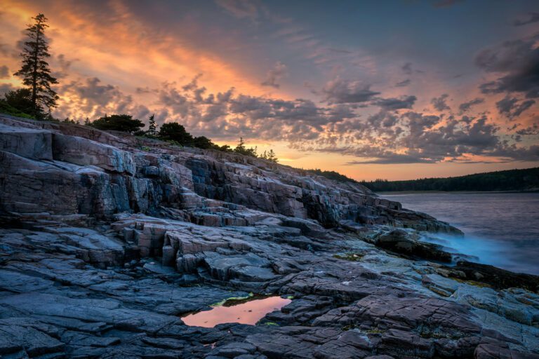
6. Writing on Stone Provincial Park – Milk River – Hiking Alberta
Note: Writing-on-Stone Provincial Park, near Milk River, is a four-hour drive from Calgary. An overnight could be considered as an alternative to a very long day. This pristine, little park is isolated near the Montana border in South-east Alberta and offers a unique, incredibly beautiful and historically rich experience. Highly recommended.
 Hoodoos in the beautiful and historically vibrant Milk River Valley southeast of Calgary, Alberta, Canada.
7. Forget-Me-Not Pond – Kananaskis Country – Bragg Creek – Hiking Alberta
 Gorgeous and pristine Forget-Me-Not Pond west of Bragg Creek in Kananaskis Country, Alberta Canada.
8. Baker Park – Bow River – NW Calgary – Hiking Alberta
 The Bow River from the banks of Baker Park across from Bowness Park in northwest Calgary, Alberta, Canada.
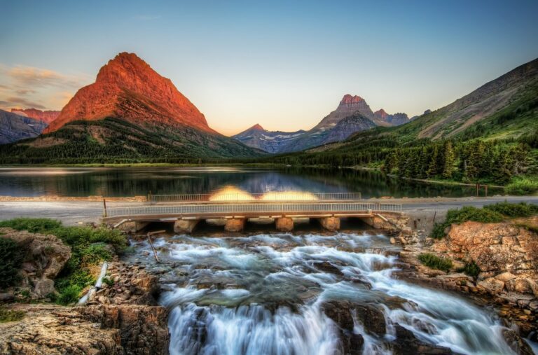
9. Cascade Ponds – Banff National Park – Hiking Alberta
 Pathways and picnic grounds beneath spectacular Cascade Falls and Cascade Mountain in Banff National Park, Alberta, Canada.
10. Barrier Lake Lookout – Kananaskis Country – Hiking Alberta

Guard Tower # 8 in Kananaskis Country, Alberta, Canada
These ten examples are only a few among many possibilities. The City of Calgary is a mecca for outdoor recreational opportunity.
The City of Calgary publishes a paper pathway map annually. There is also a downloadable PDF electronic version as well as a mobile app.